
If you are a photography collector you might want to grab one of these beauties from emerging artist David Thomas Smith. Read about his work below:
ANTHROPOCENE
“We are entering an age that might someday be referred to as, say, the Anthropocene.
After all, it is a geological age of our own making.”
– A. Revkin
Composited from thousands of digital files drawn from aerial views taken from internet satellite images, this work reflects upon the complex structures that make up the centres of global capitalism, transforming the aerial landscapes of sites associated with industries such as oil, precious metals, consumer culture information and excess. Thousands of seemingly insignificant coded pieces of information are sown together like knots in a rug to reveal a grander spectacle.
Gallery Representation: The Copper House Gallery
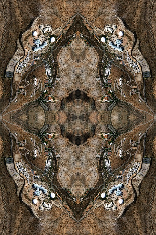


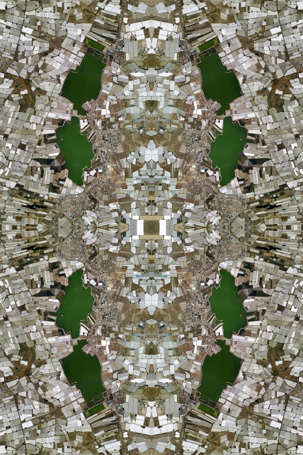
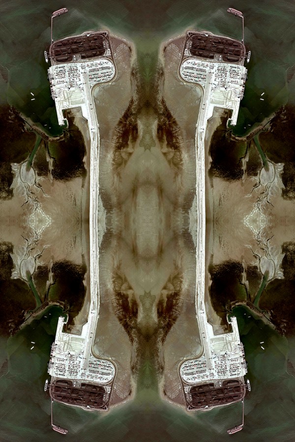

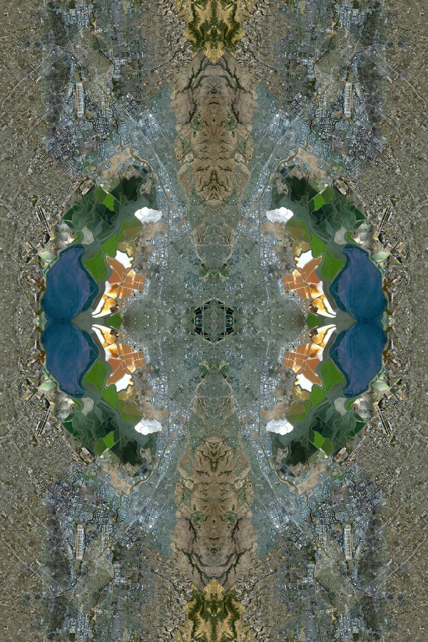
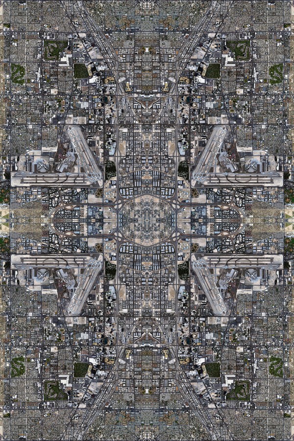

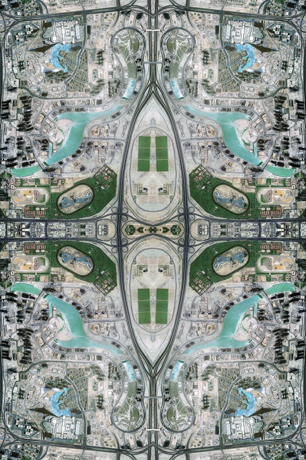

This aren’t aerial photos, they are used Persian rugs.
Martin Shofner, AIA, LEED ArchitectSure, pllc 1612 16th Avenue South Nashville, TN 37212
615.383.1991 http://www.ArchitectSure.com
Love it! I would like to see included some places that don’t need reflection post processing, as a trial for the viewer.. Like dubai created islands, foster city CA, or the vast grid of Chicagoland…
S
Sent from my iPhone